Monday, January 15, 2007

Grace Dieu Priory

  • Walked: 14th Jan 2007.
  • Distance: 8.5m
  • Walking time 5 hrs
  • Terrain: flattish, muddy!
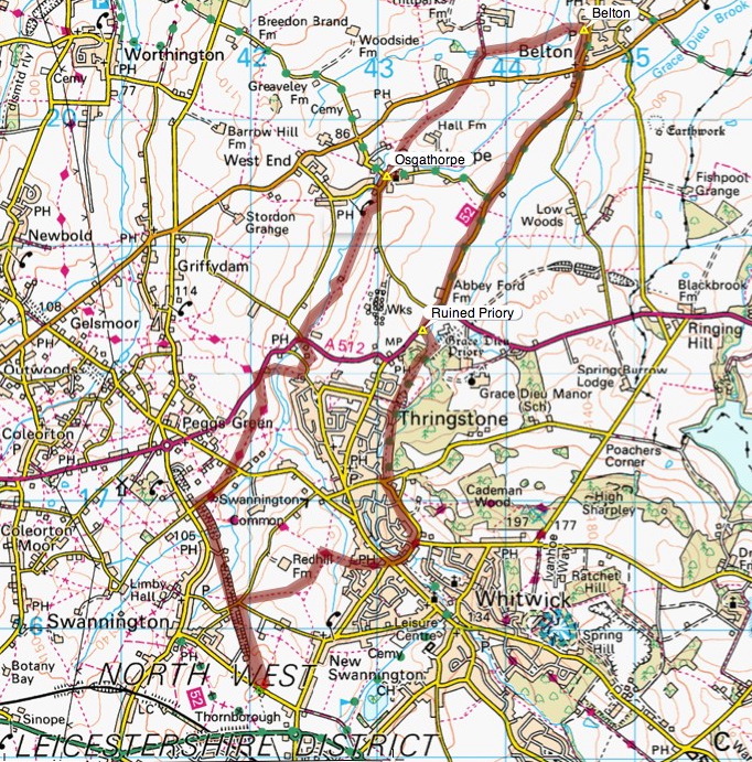
  • Summary: From Swannington (north of Coalville), walk the 'inclined plane' dismantled railway, Osgathorpe, Belton and back via cycle path.
  • map: Explorer 245


This is what remains of a 'rope-hauled inclined plane' railway, built by Robert Stephenson. This little bit of track has been left, with a few information boards standing around it.


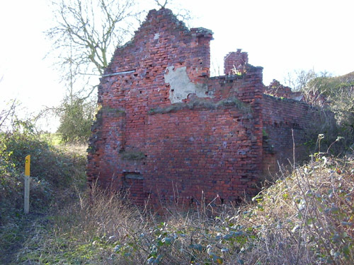
You can walk along the path of the dismantled railway, down the 1 in 17 incline, and then pick up the Ivanhoe Way. We decided that this was an old pumping station:


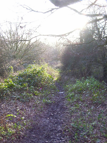
There are a number of tumbledown houses along this path, which give the feeling that you've gone to sleep like Rip Van Winkle and woken up in some post-apocolyptic world.


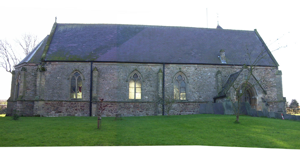
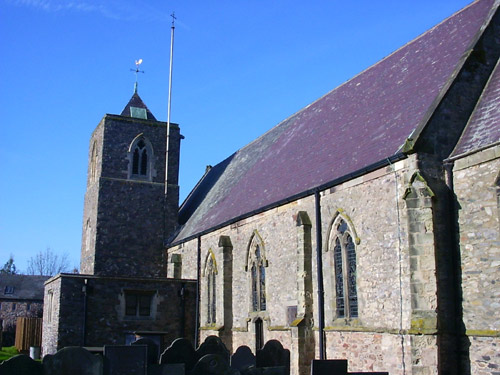
Osgathorpe is a great name, and sounds like the name of a bold Viking. This is Osgathorpe church, which is absolutely delightful. (I'm sure Dive can fill in some architectural details). I particularly liked the traditional weathercock on top of the tower.


We'd had a lot of rain this week. I didn't realise just how much rain until we found ourselves almost knee-deep in mud, the paths between Osgathorpe and Belton were the worst.


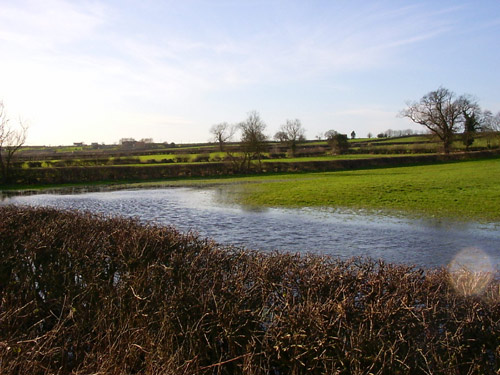
We had planned to take footpaths out of Belton, but after experiencing the seriously boggy conditions, we decided that the cycle route would be a better idea. This shot shows just how wet some of the fields were.


After crossing the A512, the Grace Dieu Priory comes into view:


The cycle path follows another old railway line, although the tarmac path goes alongside the old railway. We found our way up to the dismantled line itself which was far more pretty.


We eventually meet the inclined plane once more, and follow it back to the car. This time it's uphill, of course, and I have to admit that 1 in 17 is steeper than it sounds!


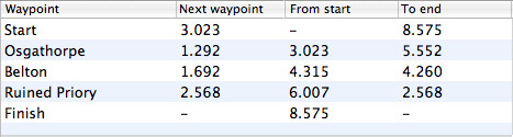
Stats:


The route and distance statistics above were generated using Meander.

Image produced from the Ordnance Survey Get-a-map service. Map image reproduced with kind permission of Ordnance Survey and Ordnance Survey of Northern Ireland.

Monday, January 01, 2007

Start as you mean to go on (Leicestershire 3 Peaks second offensive) (updated)

  • Walked: 1st Jan 2007. Previously 19th November 2006
  • Distance: 12m
  • Walking time 5.5 hrs
  • Terrain: The clue's in the title
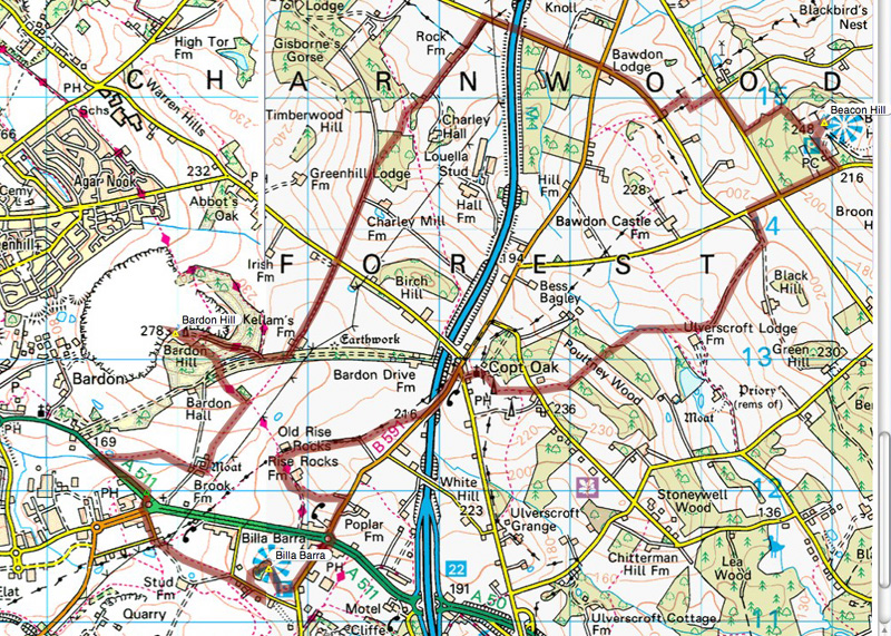
  • Summary: From the A511 between Coalville and Leicester, walk to Bardon Hill, then Beacon Hill, before returning via Billa Barra.
  • map: Explorer 245
  • Note to self: Write to Leics council about the footpath at SK471131. Create a 4-Peaks walk


Start as you mean to go on. Yes, it's true, we were up at the crack of dawn on New Year's day. The last time we tried this walk, we didn't quite make the last peak due to bad light stopping play. [Edit - though I now have a decent torch and am planning a moonlight walk sometime]. That's the reason I was jumping out of bed on New Year's Day before it was light. We were walking by 8.30 and arrived back at the car at 2pm.

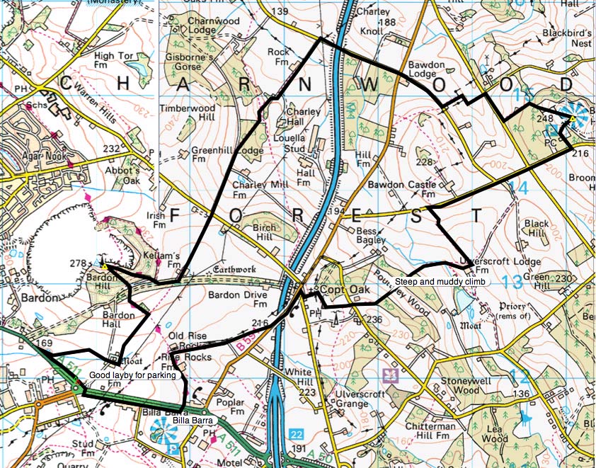
There's a really useful lay-by at SK458120, on the A511 between Bardon and the M1. You have to walk back towards Bardon for a couple of hundred metres to find the footpath.

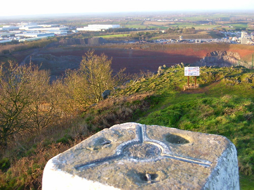
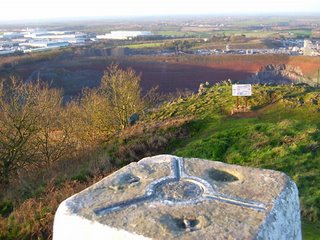
This time I've made a point of taking pictures of the peaks themselves. This is another view from the top of Bardon hill, just by the trig point, looking towards (and into) the adjacent quarry:

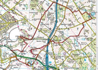
Last time we were baffled by the fact that a new and a slightly older OS map shows the public right of way at SK471131 taking slightly different routes. Today we took the route shown on the up-to-date OS map, which is a straight line (see the map below - just by the 'F' of Forest). We had to conclude that this is simply wrong. The path wasn't marked at all (Leicestershire are usually brilliant at maintaining stiles, arrow discs and yellow posts), it wasn't easily passable and having reached the road, we had to climb over barbed wire to get onto the road, and looked back at a sign saying 'no public access'. Hmmm. The alternative, marked on the older OS map and following the powerlines, is clearly marked with stiles and good fingerposts.

[Edit - I've now had a reply from Leicestershire County Council: "You should follow the waymarked route for the time being. This is a temporary diversion for mineral planning reasons. The order is due to end in November 2008, unless an extension is sought. The route will then return to the track past Kellams Farm." I'm still confused about why the 'diversion' (following the powerlines) is shown on the older map but not the newer one, and I also feel that the temporary path should be more clearly marked at the farmhouse end, with a brief explanation.]

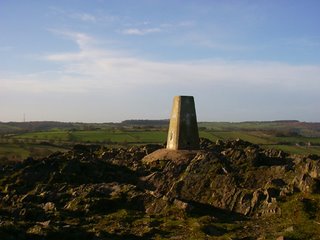
This is the trig point at the top of Beacon Hill. As mentioned before, there's a car park quite close to the top. I can't help feeling a little miffed that having earned the fantastic view by making the long walk up, you're sharing the same view with young families and dog walkers who've walked about a hundred yards to get there:

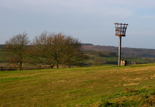
Just over the top, we think this is the Beacon that the hill is named after:


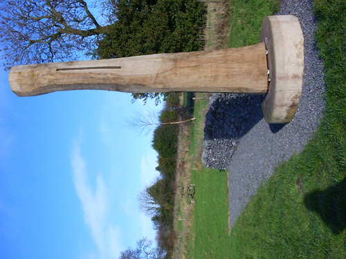
Having made it to Billa Barra this time, we find this sculpture by David Nash. It rings of stonehenge etc, as it has a thin slit which means that its shadow has a thin line of light in the middle at "true noon" each day.

[Edit - There are six of these Noon Columns in the National Forest. David Nash says "It is a wonderful fact of nature and geometry that the sum is always due south at Noon, each day higher approaching Summer, each day lower approaching Winter." Sophie Churchill of the National Forest Company says "These columns speak to us of the changelessness of the sun and the amazing properties of old wood. They also speak to me of how humans have worked the landscape". Additional funding for the columns came from the Arts Council England and private sponsor Viv Astling. Hurray for everyone concerned.]


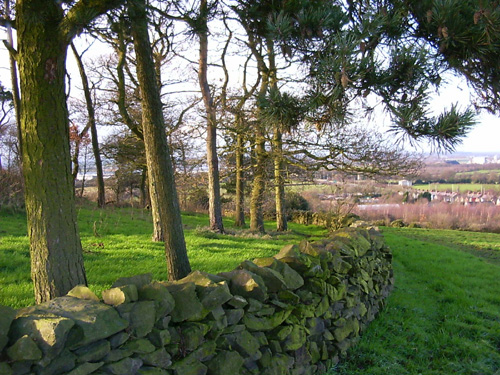
There's no trig point at the top of Billa Barra, but this is the 'crown' of trees that identifies this hill. The view is quite excellent. A great spot to eat left-over Christmas cake and drink remaining coffee. This is just a short walk via a beautiful path back to the car.
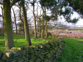

I notice having tried this '3 Peaks' walk for the second time, that the map shows another peak fairly close by at Markfield, which is also marked as a 360-degree viewpoint. When we have longer days [or a torch with me], I think I'll try a '4-peaks' walk!


Stats:


The route and distance statistics above were generated using Meander.

Image produced from the Ordnance Survey Get-a-map service. Map image reproduced with kind permission of Ordnance Survey and Ordnance Survey of Northern Ireland.

Sunday, December 31, 2006

Felbrigg and Norfolk Coast

  • Walked: 28th December 2006
  • Distance: 5.4m
  • Terrain: Farily flat
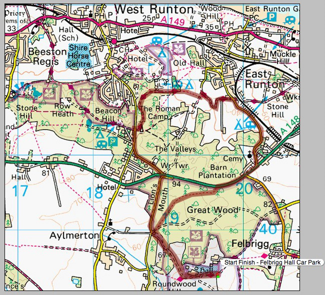
  • Summary: Starting at Felbrigg Hall car park, use the lane known as the Lion's Mouth, cross the A148 and pick up the Norfolk Coastal Path, turning off to Cromer Cemetary and crossing the 148 again, back though woods to the start.
  • Time: 2 hrs


This is Felbrigg Hall, a real mix of architectural styles:


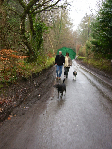
These lovely people are my Mum and Dad (and their pooches). Dad is trying to pretend that he didn't want to walk quite so far, but he doesn't know that we know that's just a lovably grumpy persona he puts on sometimes for a laugh.


The Lion's Mouth is a lane which goes through the Great Wood which has some wonderful trees such as this one:


After crossing the A148 (Cromer - Holt road), we pick up a well-marked path which I took (from the map) to be the Weavers Way, but is in fact the Norfolk Coastal Path. If you ever catch me saying that my adopted home (Derbyshire) is more beautiful than my original home (Norfolk), this picture is only one example which makes a lie of that. And it's NOT FLAT!! That's a misconception which arises from a misguided line in some Noel Coward play.


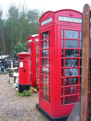
Just before an obvious railway bridge, turn right and follow the road back, past the beautiul cemetary church, back to the A148. If you've driven along this road, you will have seen this yard full of wonderful memorabilia for sale. When Meander eventually makes my fortune, I'll be back for one of these old red telephone boxes (No America, you don't see many in use now).


Along the 148 a little way, and then there's a right of way back through the Great Woods. It takes you past this Ice House. The idea was that you collected ice from the frozen lake in the winter, and put it in this underground house, where it would remain frozen until you wanted some for your G & T in July. Apparently.


The route above was generated using Meander.

Image produced from the Ordnance Survey Get-a-map service. Map image reproduced with kind permission of Ordnance Survey and Ordnance Survey of Northern Ireland.
Wednesday, November 29, 2006

Get Orf My Land.... or 8-mile figure of 8

  • Walked: 26th November 2006
  • Distance: 8m
  • Terrain: Some inclines
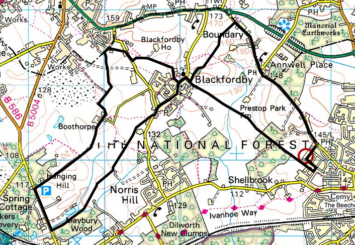
  • Summary: Starting at the Heart of The National Forest, Ashby de la Zouch, walk to Blackfordby, continue out to Woodville, then back in a loop to Blackfordby and a different Route back to Ashy (Possibly starting and finishing at The Beeches pub, well worth a swift visit).
  • Time: 2.5 hrs


This is one of my most regular short walks, I start from my home so no driving at all. We go via some National Forest, which is still very new in tree terms, but some of the trees here are now higher than a person. Almost from the start, you can see Blackfordby spire, which remains visible for most of this walk. The beautifully-shaped spire looks black in sillhouette from a distance, but as you can see from this picture, it is quite black:


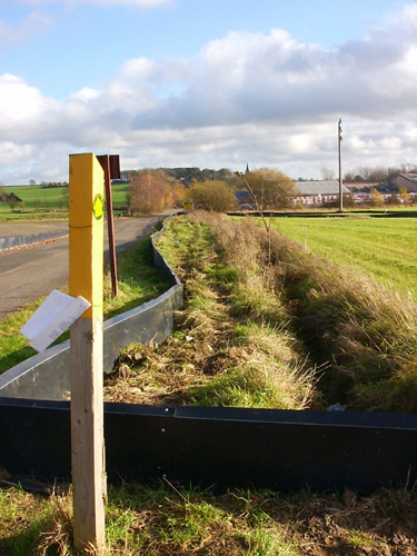
When we came close to Woodville, we spotted these very strange low barriers. with buckets sunk into the ground. We guessed drainage, or barriers for rabbits or other animals. When we came to this waypost, the flapping sign on it told us that the barriers and 'bucket traps' are catching greater crested newts for 'translocation'. (What's wrong with the word relocation...? Or even eviction, come to that).


It seems that developers want to build lots of ugly buildings on quite a large area of this land, which is now quite beautiful. Hmmmm. However, there are some rare newts in residence, and so the developers are making a gesture by finding some and taking them somewhere else where they'll pine away.

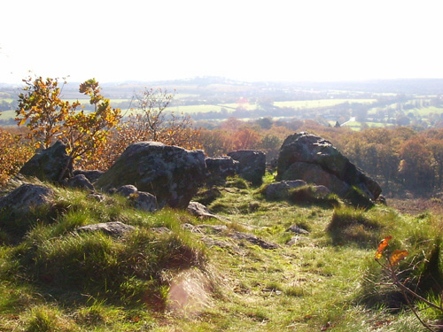
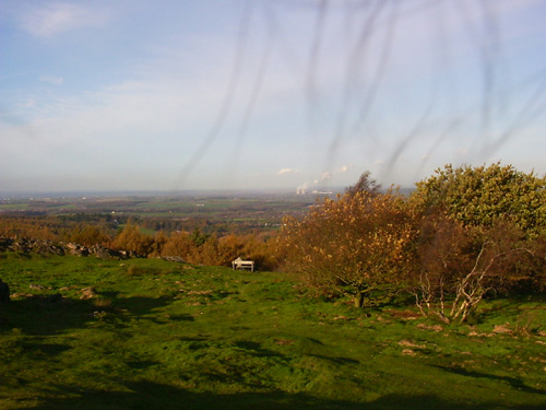
These are views from Gorse Lane, the first at Boothorpe and the second just a bit further on:


You emerge on the road between Albert Village and Donisthorpe. It's not a very pleasant walk along the road, but it's not far. Look out for the footpath on the left, right at the bottom of the hill before the factories. The next section is very pleasant and gently rolling. The mining heritage of the area just isn't apparent any more... or is it? The hill on the horizon right in the middle of this picture is, we think, a slag heap from an open cast mine which we think may still be working:


We pass Blackfordby church once more, and go back to the starting point by a slightly different way, which uses the Burton Road back into Ashby. It's quite a busy road, but the views are great.


The route above was generated using Meander.

Image produced from the Ordnance Survey Get-a-map service. Map image reproduced with kind permission of Ordnance Survey and Ordnance Survey of Northern Ireland.

Monday, November 20, 2006

Shiela's Leicestershire 3-Peaks Challenge

  • Walked: 19th November 2006
  • Distance: 11.5m
  • Terrain: The clue's in the title
  • Summary: From the A511 between Coalville and Leicester, walk to Bardon Hill, then Beacon Hill, before returning via Billa Barra.
  • Time: 5.5 hrs
  • Note to self: Find out why the footpath at SK471131 has disappeared from the map!

The title of this walk is tongue-in-cheek, and based on the 'real' 3 Peaks Challenge. (In title only!) This walk was hastily-planned when we realised that the weather wasn't going to be as the weather forecast had suggested, very wet, but very pleasant and sunny. I've been up Bardon Hill and Billa Barra before, but it was with a squeal of delight that we realised that it would be easy to climb these two 'peaks', and make Beacon Hill too. We're only talking 250 metres high, but Leicestershire is a flat county. Bardon hill is apparently the highest point in Leicestershire.

There's a really useful lay-by at SK458120, on the A511 between Bardon and the M1. You have to walk back towards Bardon for a couple of hundred metres to find the footpath.

This is the real live genuine moat around Brook Farm:


Curling around to the left and picking up the Ivanhoe Way takes you to the top of Bardon Hill. This is the view from the top. Billa Barra, the third peak on this walk, is just about visible through the mist on the horizon in the middle of the picture.


Follow the road down and at the bottom, don't follow the footpath round to the left, instead, cross the track which is used by the quarry traffic and cut through to the tarmac road just beyond. At the farm, pick up the footpath. I'm not sure what's going on here, maybe a path has been moved, but according to the slightly older Explorer 245 we were using on Sunday, the right of way follows the power line to the road, skirting the ancient circular earthwork. On my more up to date Explorer, this path isn't marked, there's just the straight one joining Kellam's Farm and Upper Greenhill Farm. Hmmm.

We walk almost a straight line to a small road which goes beneath the M1. Follow some minor roads and footpaths to Beacon hill Country Park. It was disappointing to find that due to a car park close to the top of this hill, we were far from alone. A view this damn good deserves working for - not driving nearly to the top and doing the last few metres in fashionable heels!

My picture doesn't do the view justice. The strange wiggly lines in the sky are my hair, I think.


A short road walk before picking up footpaths again, through to Copt Oak. The radio masts there are good landmarks to head for. We cross the M1 once more. This is our premier motorway - remarkably quiet today:


Another bit of the Ivanhoe Way takes us back towards Billa Barra. I have to confess that we didn't finish the 'challenge' and make that third peak, due to a combination of cold, hunger, and being temptingly close to the car. This is that third peak with its intriguing crown of trees:


The route above was generated using Meander.

Image produced from the Ordnance Survey Get-a-map service. Map image reproduced with kind permission of Ordnance Survey and Ordnance Survey of Northern Ireland.
Friday, November 10, 2006

Revisiting Childhood

  • Walked: 10th November 2006
  • Distance: 2.5m
  • Terrain: flat
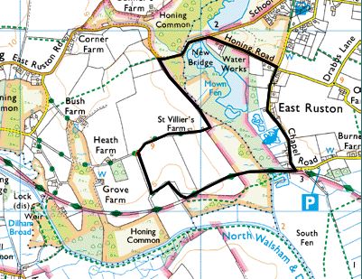
  • Summary: Park at honing, walk across common land and Weavers Way, then by road back to the start.
  • Time: 1 hr
  • Note to self: walk the Weavers Way again.


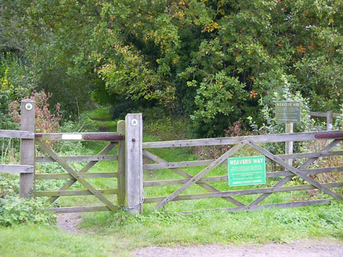
I remember walking the Weavers Way as a child. This short walk during a stay with the folks briefly revisits the disused railway.

This is the area where my Dad grew up. Here he is with his dog:

The path takes in a bit of the Weavers Way. On this walk, we leave the path here but it continues to Stalham and Hickling Broad.

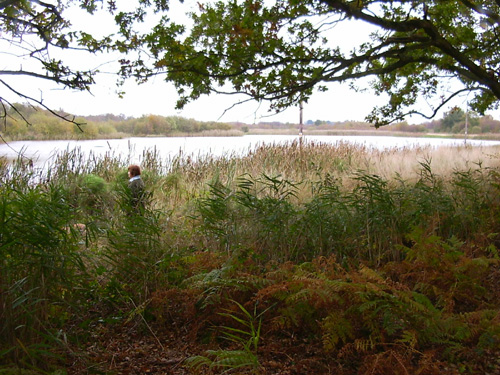
This beautiful piece of water is known locally as a 'scrape'. It was created by digging some ground out of a boggy area, in order to provide a duck hunting area.

The route above was generated using Meander.

Image produced from the Ordnance Survey Get-a-map service. Map image reproduced with kind permission of Ordnance Survey and Ordnance Survey of Northern Ireland.
Beach and Clifftop

  • Walked: 7th November 2006
  • Distance: 4.8m
  • Terrain: flat, with steep slopes up to cliff and Village.
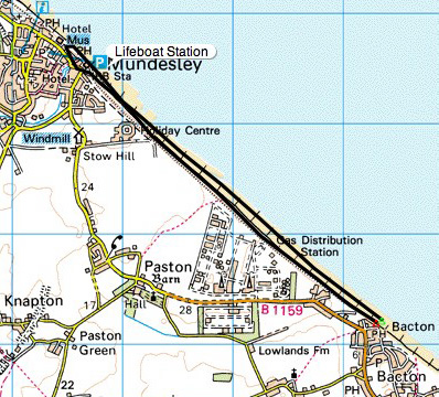
  • Summary: Park at Bacton, walk along the beach to Mundesley and back along the clifftop.
  • Time: 2 hrs
  • Notable views: All of it!
  • Note to self: investigate the Paston Way.


This is the first of two short walks taken with Mum and Dad during a week's holiday back in Norfolk visiting friends and family.

In November, these coastal villages are asleep. Some fantastic beach and sky views can be enjoyed almost alone!

Park at Bacton, walk along the beach to Mundesley. Climb the slope at the lifeboat station and into Mundesley. We enjoyed an out-of-season coffee and walked back down to the beach. At the lifeboat station climb up the slope and join the clifftop path:

Despite bits of the cliff continuously falling onto the beach, a right of way along the clifftop is maintained. The views are just fantastic, and explode the "flat Norfolk" myth!!

The route above was generated using Meander.

Image produced from the Ordnance Survey Get-a-map service. Map image reproduced with kind permission of Ordnance Survey and Ordnance Survey of Northern Ireland.

Tuesday, October 24, 2006

Packington and Normanton

  • Walked: 24th October 2006
  • Distance: 5.5m
  • Terrain: flattish
  • Summary: Park in packington, cross fields to Sprng Lane and continue straight along track. Take the muddy bridleway to Normanton le Heath, and take paths which run parallel to the road back to Packington.
  • Time: 2 hrs
  • Notable views: Difficult to spot any as it got dark earlier than I expected!
  • Note to self; Make sure camera has good batteries in it next time.


The next time a smug dog-walking local asks "where are you trying to get to?" And then tries to give me directions by road, blood will be spilled - I swear it will. I'm sure there's a smart answer, but I've not thought of it yet.

By the time I got through Normanton, it was darker than I'd anticipated, I didn't have a torch, and it probably would have been more sensible to take the road, but having argued with aforementioned dickhead about the fact that footpaths existed and that I would be using them, I had to cross the fields as a matter of principle. Thus I discovered how pleasant it is to be in the unlit countryside at night. Luckily, the paths in question were relatively un-hazardous and despite not being able to pick out Leicestershire's excellent yellow way posts very well, didn't get lost.

I've been a bit blue about the fact that it's now getting dark way too early, and I can't walk after work any more, but I think that the purchase of a decent torch might open up new possibilities!


The route above was generated using Meander.

Image produced from the Ordnance Survey Get-a-map service. Map image reproduced with kind permission of Ordnance Survey and Ordnance Survey of Northern Ireland.
Monday, October 16, 2006

Hayes vs Haze

  • Walked: 16th October 2006
  • Distance: 17.4m
  • Terrain: flattish
  • Summary: Ashby to Calke, Ticknall, Melbourne. Across to Foremark Reservoir, straight down to Daniel Hayes and back to starting point via Smisby.
  • Time: 6.5 hrs
  • Notable views: Daniel Hayes!!
  • Note to self; For a slightly longer walk, include Anchor Church Caves.

In this post I'm going to reveal South Derbyshire's best-kept secret. The veiws from Daniel Hayes. There - I've said it - if they dig up my remains in a few weeks time then you'll know why.

No, not the opinions of one Mr Hayes .... I've no idea why a geographical feature has a human's name, but it's a high point which has lots of history and the best views of South Derbyshire. To top that, lots of it is National Forest which means open access within those areas - pith helmets on, explorers!!

This walk is pretty much the one that I wished I'd done last week, but didn't have time. This time I started and finished from home, didn't visit the farm shop and managed to cut out most of the road.

It's going to threaten my 3 viewpoints walk as my favourite circular walk! It'll only be improved by including Anchor Church Caves which are close to Ingleby.
As always, the description below isn't intended to guide you around without a copy of Explorer 245 and the ability to read it.

The Ivanhoe Way conveniently takes you from Ashby de la Zouch to Calke. The Abbey still looked good despite the grey backdrop. In the foreground is a haha, which is a way of building a wall without spoiling the view from the house.


There's a nice path which runs parallel to Calke's long approach from Ticknall. At Ticknall take paths towards Melbourne, skirting Robin Wood. On Sunday I intended to walk straight long the path by Robin Wood, but daydreamed my way to St Brides, which is worth a look as a historic building. The map at the bottom of the post shows my actual route taken.

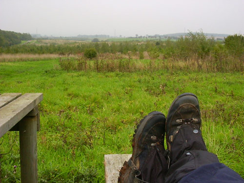
A road, then a track, then a footpath take you past Seven Spouts and then Bendalls Farm. A favourite lunch spot is Lamont Wood beside Foremark Reservoir. No-one else seems to know about it. Compare the grey photo below to the similar one on my 3-Viewpoints walk. Note the grey horizon, the gaitors and wet, muddy boots. Hmmm. it'll be Autumn, then.


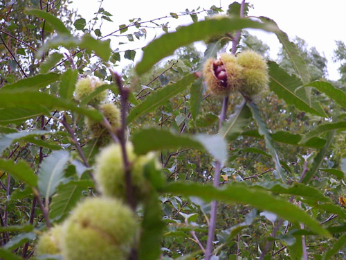
I was curious about this (still quite short) tree and its green pom-poms, which on closer investigation turn out to be sweet chestnuts. Beautiful.


After walking the length of Foremark, cross the Hartshorne -Ticknall road and bash through some very nice woodland to Daniel Hayes.

Unfortunately, the aforementioned spectacular views weren't quite so spectacular on Sunday, on account of the haze - the kind of haze which turns the sky and distant views into a very flat grey - the kind of day that prompted Bill Bryson to describe England as 'like living inside Tupperware':

"For months the sky had remained a depthless grey. Sometimes it rained, but mostly it was just dull.... It was like living inside Tupperware" - Bill Bryson

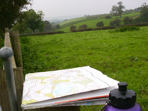
This poor photograph (including water bottle and my very tatty Explorer 245) just doesn't do the place justice.


The route above was generated using Meander.

Image produced from the Ordnance Survey Get-a-map service. Map image reproduced with kind permission of Ordnance Survey and Ordnance Survey of Northern Ireland.