Tuesday, October 24, 2006

Packington and Normanton

  • Walked: 24th October 2006
  • Distance: 5.5m
  • Terrain: flattish
  • Summary: Park in packington, cross fields to Sprng Lane and continue straight along track. Take the muddy bridleway to Normanton le Heath, and take paths which run parallel to the road back to Packington.
  • Time: 2 hrs
  • Notable views: Difficult to spot any as it got dark earlier than I expected!
  • Note to self; Make sure camera has good batteries in it next time.


The next time a smug dog-walking local asks "where are you trying to get to?" And then tries to give me directions by road, blood will be spilled - I swear it will. I'm sure there's a smart answer, but I've not thought of it yet.

By the time I got through Normanton, it was darker than I'd anticipated, I didn't have a torch, and it probably would have been more sensible to take the road, but having argued with aforementioned dickhead about the fact that footpaths existed and that I would be using them, I had to cross the fields as a matter of principle. Thus I discovered how pleasant it is to be in the unlit countryside at night. Luckily, the paths in question were relatively un-hazardous and despite not being able to pick out Leicestershire's excellent yellow way posts very well, didn't get lost.

I've been a bit blue about the fact that it's now getting dark way too early, and I can't walk after work any more, but I think that the purchase of a decent torch might open up new possibilities!


The route above was generated using Meander.

Image produced from the Ordnance Survey Get-a-map service. Map image reproduced with kind permission of Ordnance Survey and Ordnance Survey of Northern Ireland.

Monday, October 16, 2006

Hayes vs Haze

  • Walked: 16th October 2006
  • Distance: 17.4m
  • Terrain: flattish
  • Summary: Ashby to Calke, Ticknall, Melbourne. Across to Foremark Reservoir, straight down to Daniel Hayes and back to starting point via Smisby.
  • Time: 6.5 hrs
  • Notable views: Daniel Hayes!!
  • Note to self; For a slightly longer walk, include Anchor Church Caves.

In this post I'm going to reveal South Derbyshire's best-kept secret. The veiws from Daniel Hayes. There - I've said it - if they dig up my remains in a few weeks time then you'll know why.

No, not the opinions of one Mr Hayes .... I've no idea why a geographical feature has a human's name, but it's a high point which has lots of history and the best views of South Derbyshire. To top that, lots of it is National Forest which means open access within those areas - pith helmets on, explorers!!

This walk is pretty much the one that I wished I'd done last week, but didn't have time. This time I started and finished from home, didn't visit the farm shop and managed to cut out most of the road.

It's going to threaten my 3 viewpoints walk as my favourite circular walk! It'll only be improved by including Anchor Church Caves which are close to Ingleby.

As always, the description below isn't intended to guide you around without a copy of Explorer 245 and the ability to read it.

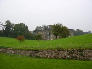
The Ivanhoe Way conveniently takes you from Ashby de la Zouch to Calke. The Abbey still looked good despite the grey backdrop. In the foreground is a haha, which is a way of building a wall without spoiling the view from the house.


There's a nice path which runs parallel to Calke's long approach from Ticknall. At Ticknall take paths towards Melbourne, skirting Robin Wood. On Sunday I intended to walk straight long the path by Robin Wood, but daydreamed my way to St Brides, which is worth a look as a historic building. The map at the bottom of the post shows my actual route taken.

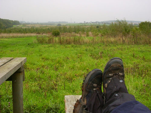
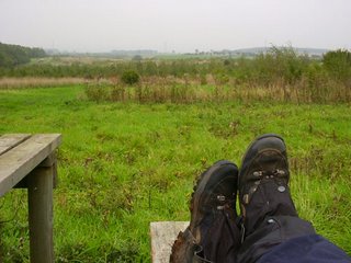
A road, then a track, then a footpath take you past Seven Spouts and then Bendalls Farm. A favourite lunch spot is Lamont Wood beside Foremark Reservoir. No-one else seems to know about it. Compare the grey photo below to the similar one on my 3-Viewpoints walk. Note the grey horizon, the gaitors and wet, muddy boots. Hmmm. it'll be Autumn, then.


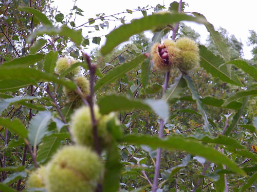
I was curious about this (still quite short) tree and its green pom-poms, which on closer investigation turn out to be sweet chestnuts. Beautiful.


After walking the length of Foremark, cross the Hartshorne -Ticknall road and bash through some very nice woodland to Daniel Hayes.

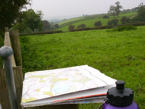
Unfortunately, the aforementioned spectacular views weren't quite so spectacular on Sunday, on account of the haze - the kind of haze which turns the sky and distant views into a very flat grey - the kind of day that prompted Bill Bryson to describe England as 'like living inside Tupperware':

"For months the sky had remained a depthless grey. Sometimes it rained, but mostly it was just dull.... It was like living inside Tupperware" - Bill Bryson

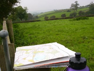
This poor photograph (including water bottle and my very tatty Explorer 245) just doesn't do the place justice.


The route above was generated using Meander.

Image produced from the Ordnance Survey Get-a-map service. Map image reproduced with kind permission of Ordnance Survey and Ordnance Survey of Northern Ireland.

Wednesday, October 11, 2006

Farm Shop from Ticknall (or Meat Run)

  • Walked: 8th October 06
  • Distance: 7m
  • Terrain: flat
  • Summary: Park somewhere in Ticknall, pick up the path which skirts Robin Wood. At the radio mast, turn right to pass St Brides and out onto the B587. Walk along this road and then find the path which carries on straight to Chantry Farm Shop. Buy some decent meat and then head due West along the road, then a track, then a footpath which again skirts Robin Wood. Follow paths past Seven Spouts Farm and turn left at hangman's Stone back to Ticknall.
  • Time: 3.5 hrs
  • Notable views: One of my favourite South Derbyshire views from the trig point just above St Bride's.
  • Note to self; Don't take it for granted that the Farm Shop's open on a Sunday!

As the title suggests, the intention was to buy some meat for Sunday dinnder from Chantry Farm Shop at King's Newton (by Melbourne). I buy all of my meat from them, safe in the knowledge that it's properly raised - you can taste the difference!


The typical South Derbyshire view below was taken about a mile after the Farm Shop, looking back towards it.


I didn't have time on Sunday to walk all the way from home (would have been over 20m) and so devised this walk which involved driving to Ticknall and walking from there. It was a beautiful day and despite the long sections of road, the walk from Ashby would have been wonderful.


The route above was generated using Meander.

The map image originated from the Ordnance Survey Get-a-map service. Map image reproduced with kind permission of Ordnance Survey and Ordnance Survey of Northern Ireland.