- Walked: 1st Jan 2007. Previously 19th November 2006
- Distance: 12m
- Walking time 5.5 hrs
- Terrain: The clue's in the title
- Summary: From the A511 between Coalville and Leicester, walk to Bardon Hill, then Beacon Hill, before returning via Billa Barra.
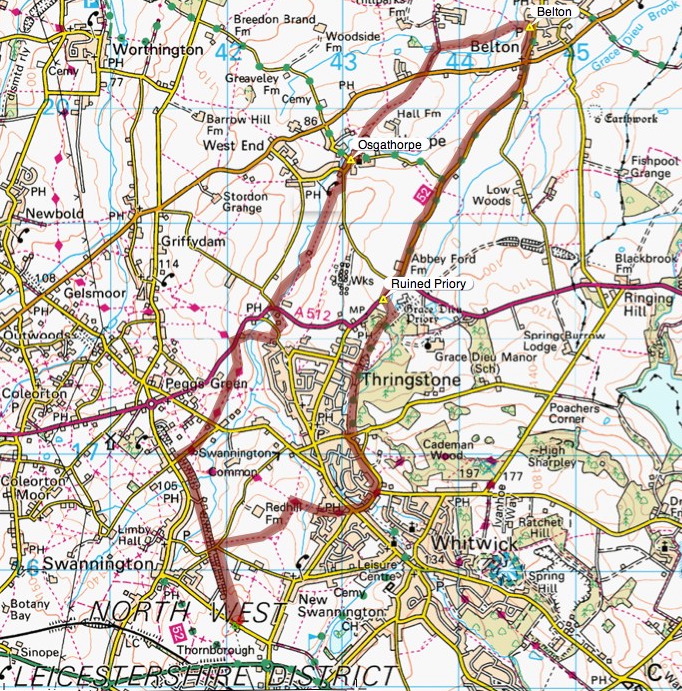
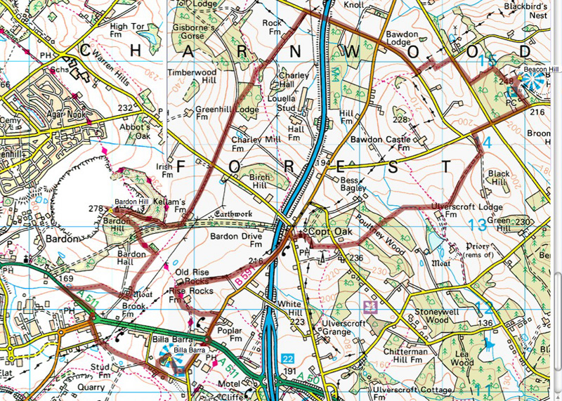
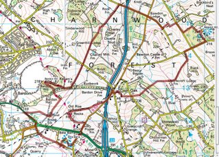
- map: Explorer 245
- Note to self: Write to Leics council about the footpath at SK471131. Create a 4-Peaks walk
Start as you mean to go on. Yes, it's true, we were up at the crack of dawn on New Year's day. The
last time we tried this walk, we didn't quite make the last peak due to bad light stopping play. [Edit - though I now have a decent torch and am planning a moonlight walk sometime]. That's the reason I was jumping out of bed on New Year's Day before it was light. We were walking by 8.30 and arrived back at the car at 2pm.
There's a really useful lay-by at SK458120, on the A511 between Bardon and the M1. You have to walk back towards Bardon for a couple of hundred metres to find the footpath.
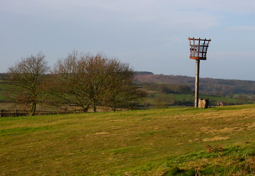
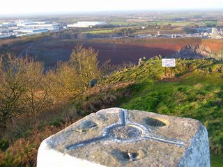
This time I've made a point of taking pictures of the peaks themselves. This is another view from the top of Bardon hill, just by the trig point, looking towards (and into) the adjacent quarry:
Last time we were baffled by the fact that a new and a slightly older OS map shows the public right of way at SK471131 taking slightly different routes. Today we took the route shown on the up-to-date OS map, which is a straight line (see the map below - just by the 'F' of Forest). We had to conclude that this is simply wrong. The path wasn't marked at all (Leicestershire are usually brilliant at maintaining stiles, arrow discs and yellow posts), it wasn't easily passable and having reached the road, we had to climb over barbed wire to get onto the road, and looked back at a sign saying 'no public access'. Hmmm. The alternative, marked on the older OS map and following the powerlines, is clearly marked with stiles and good fingerposts.
[Edit - I've now had a reply from Leicestershire County Council: "You should follow the waymarked route for the time being. This is a temporary diversion for mineral planning reasons. The order is due to end in November 2008, unless an extension is sought. The route will then return to the track past Kellams Farm." I'm still confused about why the 'diversion' (following the powerlines) is shown on the older map but not the newer one, and I also feel that the temporary path should be more clearly marked at the farmhouse end, with a brief explanation.]
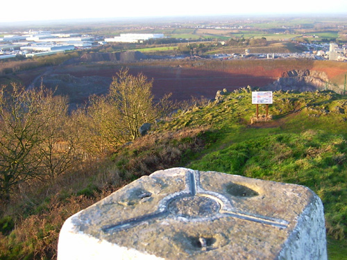
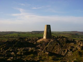
This is the trig point at the top of Beacon Hill. As mentioned before, there's a car park quite close to the top. I can't help feeling a little miffed that having earned the fantastic view by making the long walk up, you're sharing the same view with young families and dog walkers who've walked about a hundred yards to get there:
Just over the top, we think this is the Beacon that the hill is named after:

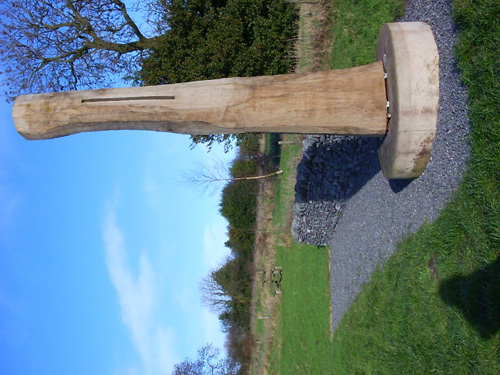
Having made it to Billa Barra this time, we find this sculpture by David Nash. It rings of stonehenge etc, as it has a thin slit which means that its shadow has a thin line of light in the middle at "true noon" each day.
[Edit - There are six of these Noon Columns in the National Forest. David Nash says "It is a wonderful fact of nature and geometry that the sum is always due south at Noon, each day higher approaching Summer, each day lower approaching Winter." Sophie Churchill of the National Forest Company says "These columns speak to us of the changelessness of the sun and the amazing properties of old wood. They also speak to me of how humans have worked the landscape". Additional funding for the columns came from the Arts Council England and private sponsor Viv Astling. Hurray for everyone concerned.]

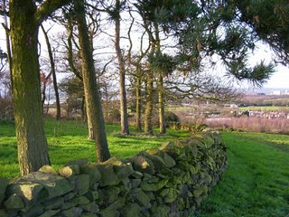
There's no trig point at the top of Billa Barra, but this is the 'crown' of trees that identifies this hill. The view is quite excellent. A great spot to eat left-over Christmas cake and drink remaining coffee. This is just a short walk via a beautiful path back to the car.
I notice having tried this '3 Peaks' walk for the second time, that the map shows another peak fairly close by at Markfield, which is also marked as a 360-degree viewpoint. When we have longer days [or a torch with me], I think I'll try a '4-peaks' walk!
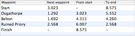
Stats:

The route and distance statistics above were generated using Meander.
Image produced from the Ordnance Survey Get-a-map service. Map image reproduced with kind permission of Ordnance Survey and Ordnance Survey of Northern Ireland.