Tuesday, October 24, 2006

Packington and Normanton

  • Walked: 24th October 2006
  • Distance: 5.5m
  • Terrain: flattish
  • Summary: Park in packington, cross fields to Sprng Lane and continue straight along track. Take the muddy bridleway to Normanton le Heath, and take paths which run parallel to the road back to Packington.
  • Time: 2 hrs
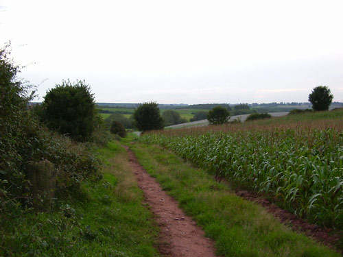
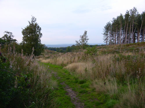
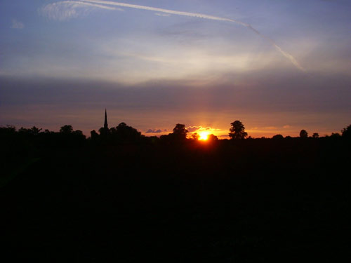
  • Notable views: Difficult to spot any as it got dark earlier than I expected!
  • Note to self; Make sure camera has good batteries in it next time.


The next time a smug dog-walking local asks "where are you trying to get to?" And then tries to give me directions by road, blood will be spilled - I swear it will. I'm sure there's a smart answer, but I've not thought of it yet.

By the time I got through Normanton, it was darker than I'd anticipated, I didn't have a torch, and it probably would have been more sensible to take the road, but having argued with aforementioned dickhead about the fact that footpaths existed and that I would be using them, I had to cross the fields as a matter of principle. Thus I discovered how pleasant it is to be in the unlit countryside at night. Luckily, the paths in question were relatively un-hazardous and despite not being able to pick out Leicestershire's excellent yellow way posts very well, didn't get lost.

I've been a bit blue about the fact that it's now getting dark way too early, and I can't walk after work any more, but I think that the purchase of a decent torch might open up new possibilities!


The route above was generated using Meander.

Image produced from the Ordnance Survey Get-a-map service. Map image reproduced with kind permission of Ordnance Survey and Ordnance Survey of Northern Ireland.

Monday, October 16, 2006

Hayes vs Haze

  • Walked: 16th October 2006
  • Distance: 17.4m
  • Terrain: flattish
  • Summary: Ashby to Calke, Ticknall, Melbourne. Across to Foremark Reservoir, straight down to Daniel Hayes and back to starting point via Smisby.
  • Time: 6.5 hrs
  • Notable views: Daniel Hayes!!
  • Note to self; For a slightly longer walk, include Anchor Church Caves.

In this post I'm going to reveal South Derbyshire's best-kept secret. The veiws from Daniel Hayes. There - I've said it - if they dig up my remains in a few weeks time then you'll know why.

No, not the opinions of one Mr Hayes .... I've no idea why a geographical feature has a human's name, but it's a high point which has lots of history and the best views of South Derbyshire. To top that, lots of it is National Forest which means open access within those areas - pith helmets on, explorers!!

This walk is pretty much the one that I wished I'd done last week, but didn't have time. This time I started and finished from home, didn't visit the farm shop and managed to cut out most of the road.

It's going to threaten my 3 viewpoints walk as my favourite circular walk! It'll only be improved by including Anchor Church Caves which are close to Ingleby.

As always, the description below isn't intended to guide you around without a copy of Explorer 245 and the ability to read it.

The Ivanhoe Way conveniently takes you from Ashby de la Zouch to Calke. The Abbey still looked good despite the grey backdrop. In the foreground is a haha, which is a way of building a wall without spoiling the view from the house.


There's a nice path which runs parallel to Calke's long approach from Ticknall. At Ticknall take paths towards Melbourne, skirting Robin Wood. On Sunday I intended to walk straight long the path by Robin Wood, but daydreamed my way to St Brides, which is worth a look as a historic building. The map at the bottom of the post shows my actual route taken.

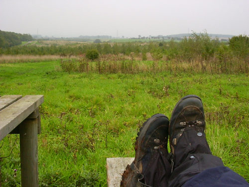
A road, then a track, then a footpath take you past Seven Spouts and then Bendalls Farm. A favourite lunch spot is Lamont Wood beside Foremark Reservoir. No-one else seems to know about it. Compare the grey photo below to the similar one on my 3-Viewpoints walk. Note the grey horizon, the gaitors and wet, muddy boots. Hmmm. it'll be Autumn, then.


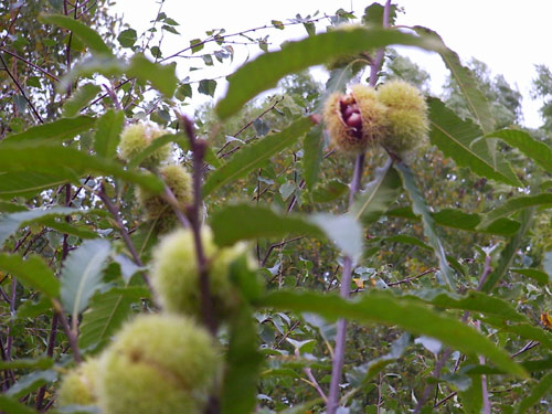
I was curious about this (still quite short) tree and its green pom-poms, which on closer investigation turn out to be sweet chestnuts. Beautiful.


After walking the length of Foremark, cross the Hartshorne -Ticknall road and bash through some very nice woodland to Daniel Hayes.

Unfortunately, the aforementioned spectacular views weren't quite so spectacular on Sunday, on account of the haze - the kind of haze which turns the sky and distant views into a very flat grey - the kind of day that prompted Bill Bryson to describe England as 'like living inside Tupperware':

"For months the sky had remained a depthless grey. Sometimes it rained, but mostly it was just dull.... It was like living inside Tupperware" - Bill Bryson

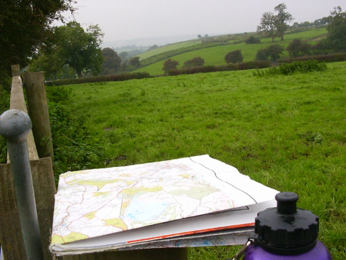
This poor photograph (including water bottle and my very tatty Explorer 245) just doesn't do the place justice.


The route above was generated using Meander.

Image produced from the Ordnance Survey Get-a-map service. Map image reproduced with kind permission of Ordnance Survey and Ordnance Survey of Northern Ireland.

Wednesday, October 11, 2006

Farm Shop from Ticknall (or Meat Run)

  • Walked: 8th October 06
  • Distance: 7m
  • Terrain: flat
  • Summary: Park somewhere in Ticknall, pick up the path which skirts Robin Wood. At the radio mast, turn right to pass St Brides and out onto the B587. Walk along this road and then find the path which carries on straight to Chantry Farm Shop. Buy some decent meat and then head due West along the road, then a track, then a footpath which again skirts Robin Wood. Follow paths past Seven Spouts Farm and turn left at hangman's Stone back to Ticknall.
  • Time: 3.5 hrs
  • Notable views: One of my favourite South Derbyshire views from the trig point just above St Bride's.
  • Note to self; Don't take it for granted that the Farm Shop's open on a Sunday!

As the title suggests, the intention was to buy some meat for Sunday dinnder from Chantry Farm Shop at King's Newton (by Melbourne). I buy all of my meat from them, safe in the knowledge that it's properly raised - you can taste the difference!


The typical South Derbyshire view below was taken about a mile after the Farm Shop, looking back towards it.


I didn't have time on Sunday to walk all the way from home (would have been over 20m) and so devised this walk which involved driving to Ticknall and walking from there. It was a beautiful day and despite the long sections of road, the walk from Ashby would have been wonderful.


The route above was generated using Meander.

The map image originated from the Ordnance Survey Get-a-map service. Map image reproduced with kind permission of Ordnance Survey and Ordnance Survey of Northern Ireland.

Wednesday, September 27, 2006

Leicestershire Round (Willoughby)

  • Walked: 24th September 06
  • Distance: 8.6m
  • Terrain: flattish
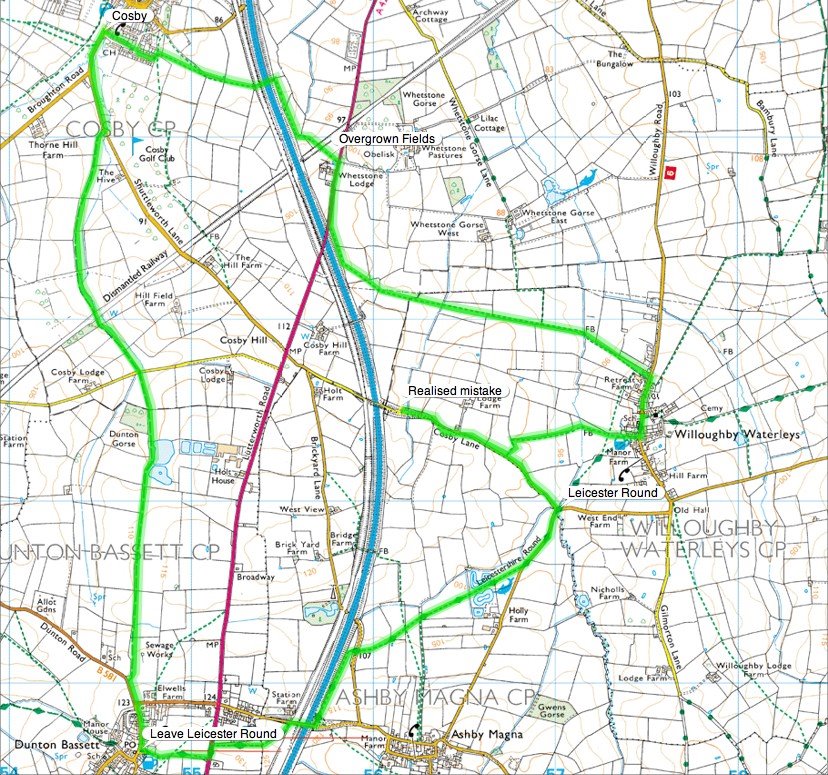
  • Summary: Park at Willoughby Waterleys, pick up the Leicestershire Round path, Follow through to Dunton Bassett, then a bridleway to Cosby, back to Willoughby.
  • Time: 4 hrs
  • Notable views: a bit flat to afford long views, but some nice ones between Dunton Bassett and Cosby
  • Note to self; take camera next time!

I discovered a few weeks ago the Leicestershire Round and how pleasant some parts of the county are, and promised myself I'd go back and investigate further.


you'll see from the map below that we immediately went astray and had to backtrack a little! I had no idea just how noisy a motorway is - you can hear it from a coule of fields away. However, walking underneath the motorway bridge (just east of Cosby) was a fascinating experience; the very loud traffic noise just disappears as you walk beneath the road, and then returns as you get back out into the open!


The long, straight bridleway is very pleasant indeed, easy to walk, easy to follow and has some lovely views.


The route above was generated using Meander.

Image produced from the Ordnance Survey Get-a-map service. Map image reproduced with kind permission of Ordnance Survey and Ordnance Survey of Northern Ireland.

Holy Island South Stack

  • Walked: 17th September 06
  • Distance: 4m
  • Terrain: cliff paths
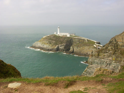
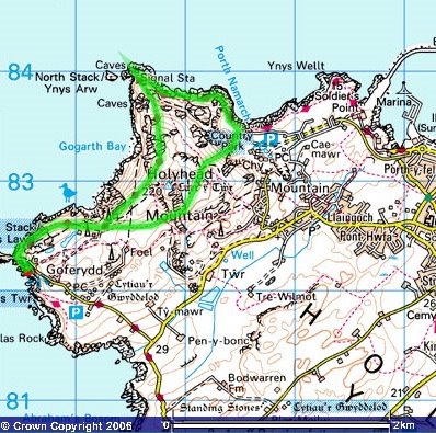
  • Summary: Park at South Stack, follow the well-marked path past South and North Stacks and around to Breakwater Country Park, then paths over Holyhead Mountain back to start.
  • Time: 3 hrs
  • Notable views: South Stack, North Stack and the coast generally!!
  • Note to self; don't knock it 'till you've tried it.

This walk is based on walk no 15 from Dorothy Hamilton's book 'Circular Walks on Anglesey'. It's listed as 'Strenuous', which, having seen how flat Anglesey and Holy Island are, we sneered at. You'll see from the contour lines on the map below, that the coast is far more hilly than the rest of the island, and the coastal path rises and falls quite dramatically!

This straight after a day's walking among the Welsh 3-thousanders, made a painful recipe and a lesson learned! Apologies to Ms Hamilton!


The route above was generated using Meander.

Image produced from the Ordnance Survey Get-a-map service. Map image reproduced with kind permission of Ordnance Survey and Ordnance Survey of Northern Ireland.

Tuesday, September 19, 2006

Bristly Ridge

  • Walked: 16th September 06

  • Distance: 5m

  • Terrain: hilly!

  • Summary: Approach Glyder Fach by Llyn Bochlwyd (lake Australia!) and Bristly Ridge. Walk the ridge between Glyder Fach and Glyder Fawr, then down via the Devil's Kitchen

  • Time: 7 hours start to finish

  • Notable views: All of it!!

  • Note to self; coming down 3000 ft is a lot harder than climbing the same. Next time exercise beforehand by finding some hills to walk down.


Bristly Ridge is approached via this gulley. This is a scramble which involves using all four limbs. Carvers' Rocks didn't prepare me for this! Bits of it are a bit scary. This day I learned the word 'cragfast'. Click the picture for a little 360 degree movie. The peak directly behind the gulley is Tryfan.


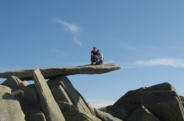
This is the obligatory photo of Rog and I standing on the Cantilever stone:


Lunch by the peak of Glyder Fach, in gorgeous sunshine:


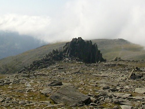
Castel-y-Gwynt means Castle of the Wind, I'm told. It's a quite remarkable rock formation:


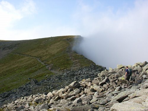
Despite being a sunny day, some cloud engulfed us briefly. After it cleared, some cloud got stuck below the ridge, creating an eerie 'end of the world' effect:


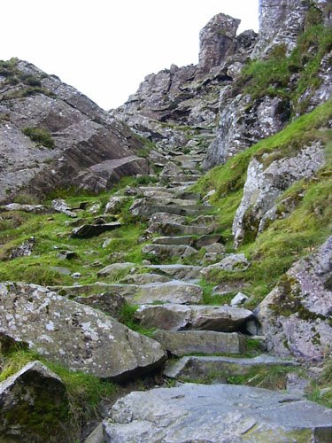
The Devil's Kitchen is, despite its name, a very pleasant descent. It's paved with large rock steps, and in parts you find yourself beside imposing black, dripping rock faces which make the name seem appropriate. I'm told that rare medicinal plants grow here too...


The route above was generated using Meander.

Image produced from the Ordnance Survey Get-a-map service. Image reproduced with kind permission of Ordnance Survey and Ordnance Survey of Northern Ireland.

Wednesday, September 13, 2006

Ticknall Circular

  • Walked: 13th September 06

  • Distance: 6.5m

  • Terrain: fairly flat

  • Summary: Walk the length of Foremark Reservoir using the straight bridleway, pick up the path which passes Bendalls Farm and Seven Spouts Farm. At Ticknall take the path which goes parallel to the Calke Abbey driveway, and cross fields back to the start point.

  • Time: 2 hours start to finish

  • Notable views: View back over the Trent Valley when approaching Ticknall.

  • Note to self; try this route in reverse, as all the good views seem to be behind you!


I just love these September sunsets, when everything turns orange and it's still warm!


This is a short walk I've used several times as a leg-strecher after work mid-week. As the nights are drawing in now, and we still have some decent weather, I was keen to fit this in this week, while it's still possible.


As always, the description below is not intended to guide anyone around without Explorer 245 and the necessary map-reading skills.


part of this walk is shared with the 3 Viewpoints walk - starting at the lower end of Foremark Reservoir, walk up the straight bridleway passing where the Wicker Jack and Jill used to be (and their wishing well still stands). At the road entrance to the reservoir, walk just a little way along the road and pick up the path which passed Bendall's Farm. (I noticed a sign this evening advertising free-range eggs for 60p per 6).


Hangman's stone is marked on the map at SK342262. it's worth turning around at this point and checking out the view behind you. In the foreground of this photo is the stone that Rog and I think might be the stone itself:


Carry on past Seven Spouts Farm, keeping to the right of the converted barn, and round to the right past the fishing pond. Walk round the edge of the pond and past some horse paddocks. Keep in pretty much a straight line to Ticknall. Before Ticknall turn around again and enjoy the view of the Trent Valey (In the misty distance here):


As I approached Ticknall church I enjoyed this lovely orange and mauve sunset:


Cross the road in Ticknall, and find the stile to the right of Calke Abbey's driveway. The footpath is delightful and runs parallel with the driveway. Leave this path to the right before the hall, cross 2 fields and then cross the Ticknall->Ashby road. From now on, the stiles and paths are hard to find, but you'll cross two fields before coming out on the road just to the right of the farm building. 110 steps along the road, pick up the footpath again the other side of the house. A further 3 fields later you're back out on the road almost at the start point.


I noticed that most of the photos that I took tonight were looking back behind me - so maybe walking this in reverse would be a good idea!


The route above was generated using Meander.

Image produced from the Ordnance Survey Get-a-map service. Image reproduced with kind permission of Ordnance Survey and Ordnance Survey of Northern Ireland.

Monday, September 11, 2006

3 Viewpoints

  • Walked: 10th September 06
  • Distance: 14m
  • Terrain: some
  • Summary: Starting from the round car park to the south of Staunton Harold Reservoir (first viewpoint), head for Breedon Church (second viewpoint). Via Melbourne through Robin Wood to Foremark Reservoir. Pause where the wicker Jack and Jill used to be and the abandoned car park at the South of Foremark Reservoir (third viewpoint). Back past the Calke estate to the finish.
  • Time: 6 hours start to finish
  • Notable views: See above - plus the view back over South Derbyshire from the trig point just before Robin Wood.
  • Notes to self: Find a path back to the car park avoiding Calke Park.

I planned this route as a 'mystery walk' for friends at the beginning of the year and have now walked it several times. This time we started in heavy mist, which soon cleared to reveal the most glorious September day. There were still some blackberries on the hedges, and as a bonus, we found a conference pear tree with ripe fruit!! (I'm keeping the location to myself!!) The description below is not intended to guide anyone around without Explorer 245 and the ability to read it!

The first viewpoint is the start / finish point - the round car park to the south of Staunton Harold Reservoir (which Ordnance Survey have marked as a viewpoint). The first mile is unfortunately along roads, but they're quite quiet, especially first thing on a Sunday! Head back along the road, (past an eye-catching newly-thatched cottage roof) and turn left at the bend to pass Dimminsdale Woods (which is noted for its carpet of snowdrops early in the year, and old lime kilns a few yards from the road - worth a look) and cross the valley bottom. Follow the road to Scotland farm, SK388222. Follow footpaths which take you in pretty much a straight line across fields and a golf course towards Breedon church. Unfortunately this time, we started off in fog, and so we had to peer through the mist to see the outline of the church on its curious bump of a hill:
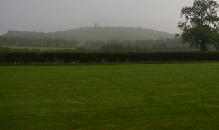
Paths bring you out on the road at the entrance to the golf course and, a little further, a garden centre which has a tearoom and loos. As you start to climb the hill, the ground is open access land. There are several paths which take you up and back down the hill. Because it's such a steep climb, you find yourself at the top surprisingly quickly! The aforementioned fog had started to clear by the time we reached the church and so although the view from the top of the hill (which includes Donington Racetrack and East Mids Airport) was a bit poor we had this great view of the church itself:
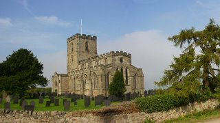
It's well worth making time to look inside the church itself - it is home to a wonderful collection of Saxon stone carvings. When you've finished, leave the top of the hill by finding the path to the north-west of the church. You'll cross a road half-way down and then come out on a tarmac road at the bottom. Walk north along this road just a short way to find the very well-marked path across another golf course. Follow paths in pretty much a straight line which take you over a ridge and down into the historic and beautiful Melbourne.

Pick up the footpath at SK375249, which takes you past St Bride's and a trig point which has a plaque on it which tells you all about it. (This photo of the trig point was taken last winter). Turn around and look behind you - the view from this point is worth a look.

The path which goes directly through Robin Wood is the muddiest quagmire that I know, and is muddy even in the driest weather. In the winter it's worth finding another way around. We hadn't had lunch at this point, and I'm pleased that we held off as we passed Seven Spouts Farm, Hangman's Stone and Bendall's Farm, because the picnic spot in the new Lamont Wood (approx 337245) was perfect; secluded and affording good views:

There used to be a 'wicker' Jack and Jill on this path towards the bottom end of the reservoir. If anyone knows what happened to them, please let me know. Their wishing well is still there (although a bit overgrown) and this is the third viewpoint. In fact, the view over the reservoir from the picnic spot just a little further on is well worth a look:
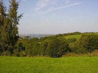
You'll find yourself in an abandoned car park - permanently locked. I have heard that this is because of night-time misuse, but I'd like to have some confirmation of this. It's actually quite fascinating to see nature reclaiming this area - moss growing over the tarmac and grass coming through it.

If time and legs allow, do locate Carver's Rocks, especially if you like a scramble. It's good fun climbing up the rocks.

The footpath brings you out on the Hartshorne -> Ticknall road. Cross and find the path which takes you past the Scaddows Farm, and then across to the Calke Park. There's a gap in the boundary wall at approx SK358230 which on this occasion we took, headed in a straight line past Betty's Pond and through the nature reserve. We've taken this path a number of times, but you do find yourself among flip-flops, push chairs and old folks with very small dogs. Being a solitary kind of person, I've resolved to find another way back to the round car park!

An interactive route map, GPX file (for loading into your favourite mapping or navigation app) and more details are all at https://uk-walks.info/viewpoints_walk.html


Tuesday, August 29, 2006

Nature's Bounty

  • Walked: 29th August 06

  • Distance: 26m

  • Terrain: fairly flat

  • Summary: starting from Shobnall, follow Millennium Way along the Trent and Mersey canal and through to Yoxall. Leave the MW and take footpaths to Braken Hurst Woods, pass the airfield and head north, skirt south of Tutbury and back to start point via Anslow.

  • Time: 11 hours start to finish, 9hours walking, 2hours stop time (according to Garmin)

  • Notable views: View over Burton from SK229244; the view all the way across to Ratcliffe power station from Hanbury and Tutbury; Anslow is a really pretty village

  • Notes to self: write to Staffs County Council about the impassable dead end at SK130197. Next time allow more time and investigate the crater at Hanbury (183277). Next time don't wear shorts as some of the paths are not well-trodden.


What could be a better way to spend an August bank holiday monday than covering 26 miles of Staffordshire? (Midlands, UK). The title given to this walk relates more to the time of year than the geography of the route - we probably managed the government's 5-a-day for the next month - the total bounty included Damsons (a delicious small blueish plum), mushrooms (I was very dubious to start with, but I'm still alive, and picked straight off the ground they were tastier and better-looking than shop-bought ones), apples (a bit sour), walnuts (not quite ripe and not eaten on route!), hops (interesting to see how bitter gets its bitter taste!), sloes (not really edible, but great for making sloe gin) and of course blackberries, which were permanently within reach.


Showers were a little bit more plentiful than the bbc had led us to believe, but our reward came near the end of the walk in the shape of the strongest most spectacular rainbow I've ever seen, like some kind of divine finishing post!!


The route above was generated using Meander. I'm heistant to publish the route complete with the map because of Ordnance Survey's licensing, but if you'd like the route superimposed on the OS map as a jpeg or in Meander file format, just email me.