- Walked: 26th November 2006
- Distance: 8m
- Terrain: Some inclines
- Summary: Starting at the Heart of The National Forest, Ashby de la Zouch, walk to Blackfordby, continue out to Woodville, then back in a loop to Blackfordby and a different Route back to Ashy (Possibly starting and finishing at The Beeches pub, well worth a swift visit).
- Time: 2.5 hrs
This is one of my most regular short walks, I start from my home so no driving at all. We go via some National Forest, which is still very new in tree terms, but some of the trees here are now higher than a person. Almost from the start, you can see Blackfordby spire, which remains visible for most of this walk. The beautifully-shaped spire looks black in sillhouette from a distance, but as you can see from this picture, it is quite black:

When we came close to Woodville, we spotted these very strange low barriers. with buckets sunk into the ground. We guessed drainage, or barriers for rabbits or other animals. When we came to this waypost, the flapping sign on it told us that the barriers and 'bucket traps' are catching greater crested newts for 'translocation'. (What's wrong with the word relocation...? Or even eviction, come to that).
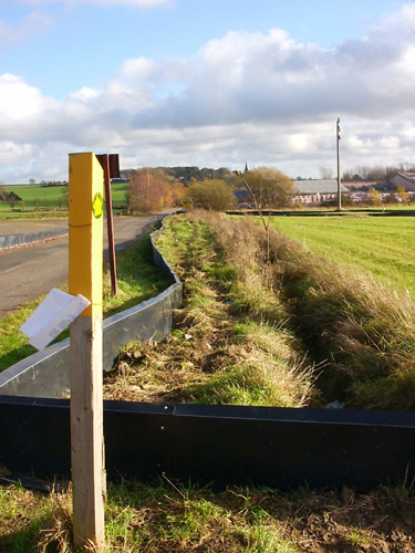
It seems that developers want to build lots of ugly buildings on quite a large area of this land, which is now quite beautiful. Hmmmm. However, there are some rare newts in residence, and so the developers are making a gesture by finding some and taking them somewhere else where they'll pine away.
These are views from Gorse Lane, the first at Boothorpe and the second just a bit further on:


You emerge on the road between Albert Village and Donisthorpe. It's not a very pleasant walk along the road, but it's not far. Look out for the footpath on the left, right at the bottom of the hill before the factories. The next section is very pleasant and gently rolling. The mining heritage of the area just isn't apparent any more... or is it? The hill on the horizon right in the middle of this picture is, we think, a slag heap from an open cast mine which we think may still be working:

We pass Blackfordby church once more, and go back to the starting point by a slightly different way, which uses the Burton Road back into Ashby. It's quite a busy road, but the views are great.
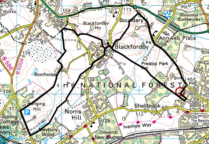
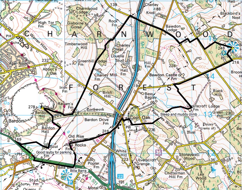
The route above was generated using Meander.
Image produced from the Ordnance Survey Get-a-map service. Map image reproduced with kind permission of Ordnance Survey and Ordnance Survey of Northern Ireland.